
Part five of the story of a walk around the Glasgow Inner Ring Road, my contribution to the Fourth World Congress of Psychogeography 2023. For part one, see here.
FIVE: Take it to the bridge

While the northern flank follows approximately the same contour line from east to west, the western flank is a rollercoaster ride from north to south. It begins with the St George’s Cross interchange, passes almost seamlessly to the Charing Cross interchange, enters a tunnel below Charing Cross, which emerges into a ditch as far as St Vincent Street where it gains legs and strides high over the River Clyde at Kingston.
The route’s switchback quality owes much to Lord Holford, who was appointed in 1961 to offer architectural advice to the highways team. William Holford, an architect and town planner, was a follower of architect Le Corbusier and planner Lewis Mumford. He was knighted in 1953 and made Baron Holford of Kemp Town by Harold Wilson in 1965, the first planner to be ennobled.
The Holford Report, by William Holford & Partners, was submitted in 1962, and included an outline of his approach to design: “The Ring Road and its connections are envisaged […] as an amenity in themselves, i.e. as an elegant and economical piece of engineering, architecture and bridge building whose outward appearance would symbolise the renewal of the city centre.”
He went further. “Far from apologising for the intrusion of the Ring Road into the scene, it can be put forward as being potentially one of its distinguishing features.”
Intrusive the M8 may have been, especially in the Charing Cross area, but it could have been much worse. Holford’s suggestions for burying the road in a tunnel and then a ditch were accepted by the planners. “We have depressed the road below the surrounding ground level, [which] has many aesthetic advantages,” he wrote.
At Charing Cross in particular, “the character of this area is such that it would have been difficult to reconcile with an elevated structure.” Holford also made suggestions about “a belt of adequate width” to be left alongside the new highway, and landscaped to provide both an attractive setting and to screen adjacent areas from traffic noise.
Where possible, he argued, these settings should include renovating adjacent buildings, “so that driving on the new roads will give a new image of Glasgow”. These days, it’s hard to square the optimism of these early reports with the reality of the tarmac curtain and the destruction and division it brought.
Our walk resumes at the modern St George’s Cross, where the writhings of the stone dragon mirror the intricacies of the traffic interchange that dominates the district. Even the highway experts behind the Sabre wiki are baffled.
Their commentary on the “sprawling mass of the M8 and its slip-roads” admits: “It is quite difficult to describe how the junction works, as in many ways it is now just the northern end of the sprawling tangle of slips that form Glasgow’s modern Charing Cross junction.” [ Link ]
Reel around the fountain
Construction of the tangled junction erased whole buildings and streets, and also exposed the backs of buildings at the un-named road that links St George’s Road to Great Western Road at street level, to the rear of West Princes Street.
St George’s Road, like North Street after it, is one-sided, like Princes Street in Edinburgh, only the view is of the truncated slopes of Garnethill rather than the castle, and viewed over the ditch of the M8 rather than the elegant Princes Street Gardens.
The Charing Cross section of the ring road didn’t pass through any Comprehensive Development Areas, and so, notes the Scottish Roads Archive, it was “consented using traditional roads powers including Compulsory Purchase Orders”.
Losses included Elders Furniture Stores (owned by the family of Eric Wolfson, the anonymous half of the Alan Parsons Project) at 42 St George’s Road (corner of Renfrew Street), Charing Cross Station at 154-56 North Street (corner of Elmbank Crescent), the St Andrew’s Ambulance building at 98-108 North Street (corner of St Vincent Street), and the Grand Hotel at 560 Sauchiehall Street (corner of Woodside Crescent). Clearly this part of the project was as expensive in financial terms as it was destructive in cultural ones.
Our route now passes the roofed section of the M8 between Woodlands Road and Sauchiehall Street, which merely adds some greenery. The wooded islands are not accessible to pedestrians, so they are very much wasted spaces.
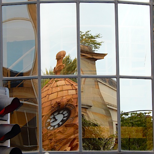
On the north side of Sauchiehall Street, the Cameron Memorial Fountain stands at a jaunty angle, its granite and terracotta pile in need of straightening and repair. Or at least a mild trim: like many uncared-for structures in Glasgow, it has a sprinkling of invasive greenery. The fountain (dry, now) was designed in 1895 by Robert Bryden of Clark & Bell to commemorate Sir Charles Cameron, newspaper editor and politician.
Cameron’s chief claim to fame is, as a radical Liberal MP, bringing in acts promoting votes for women in municipal elections, abolishing imprisonment for debts in Scotland, and reforming licensing laws in Scotland (he was a Temperance campaigner). For the psychogeographer, though, the highlight of this florid Baroque structure is a recent graffito: “No return to normal. Remember Paris May 1968.”
Glancing across the road, the memorial takes on a grotesque aspect when seen reflected in the mirrored cladding of the drum supporting the Charing Cross podium.
At Sauchiehall Street, the motorway works created three levels: the sunken road deck, the existing Sauchiehall Street and its feeders, and a “bridge” running east to west, apparently intended as part of a future flyover. Despite urban legends, this was never intended to carry traffic, but rather be a podium, a platform for some office or retail function that would help link the two severed halves of Sauchiehall Street.
The Scottish Roads Archive notes: “The Charing Cross podium was constructed at the same time as the motorway and was always intended to form part of a building. Holford suggested a shopping and leisure complex.”
A flâneur on the footbridge
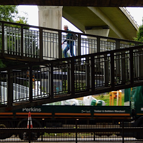
Then follows the ditch of the motorway between Sauchiehall Street and Anderston which, according to the Scottish Roads Archive, is known as the Canyon.
The site comments on “the extraordinarily expensive decision to reject a simple elevated viaduct in favour of cuttings and tunnels that protected the cityscape and prevented community severance”. Really?
The archive adds some information about the shape of the roadbed in this section: “In front of the Mitchell Library, the motorway passes over the North Clyde railway line, resulting in a visible hump in the road.”
To the south, looming large above the bridge carrying St Vincent Street over the Canyon, stands the Scottish Power tower. Around the time the motorway was built, the blocks to the north and east of this housed a number of government-linked organisations, including the Inland Revenue, the Admiralty Research Department and Strathclyde Police, which inspired two popular rumours.
First, that a government bunker had been dug out below them, the work disguised as part of the motorway excavations; and second, that there was a direct link from this bunker to the motorway. In the event of a nuclear or civil emergency, so the stories went, our rulers would either shelter in the bunker or escape to the Regional Seat of Government along the motorway, which had been closed to civilian traffic.
On the long slope down towards Anderston Station, the red sandstone bulk of St Patrick’s Roman Catholic Church in William Street, designed in early decorated Gothic by Pugin & Pugin of London in 1898, dominates the right hand side. The exterior of the church has some handsome Latin lettering. In translation, this reads: “To the glory of God (and) St Patrick, 1898” (North Street) and “The House of God” (William Street). Inside, the decorations include a statue of St Patrick, carved by Anthony Foster, apprentice to Eric Gill.
From the pedestrian overpass that links Argyle Street and Bothwell Street, the view south is of six lanes of traffic at ground level, eight lanes at the level of the Kingston Bridge and two lanes on an east-west overhead slip-road.
The pedestrian link, officially labelled the Anderston Footbridge, revels in the nickname The Bridge to Everywhere. The path, constructed at the time of the M8, was left uncompleted for decades until Sustrans brought it into use as part of National Cycle Network Route 756; it was previously known as the Bridge to Nowhere.
Next comes Anderston railway station, once the centrepiece of the handsome Anderston Cross, which has been relegated to a modern brick box with a grey metal roof, sheltering beneath the motorway. The concourse around the transport hub is brutally hostile to pedestrians. Painted concrete walls and planters, garish as a childcare facility, are dirtied by diesel smog, driven by bitter cross-winds.
From the Stobcross footbridge, strung high above the speeding traffic on the Clydeside Expressway near the station, the view expands to include the low-level railway track, adding another level below the three layers of roads visible behind it.
As I near the centre of the footbridge, an older gentleman coming towards me stops, stares at the edge of the footpath, and drops to his knees. As I pass him, I see he has a folding magnifying glass in his hand, and is closely examining what appears to be a weed growing in the crack between the footpath and the kerb, apparently living on rainwater and exhaust fumes. Like him, it appears to be a hardy perennial.
A few days after this, I come across a reference to Walter Benjamin, the German literary critic, who characterised the practice of the flâneur as “botanising the asphalt”. The phrase, which could be applied to my entire GIRR project, appears on page 36 of Charles Baudelaire, A Lyric Poet in the Era of High Capitalism (London: Verso 1977).
Wullie, where’s yer troosers?
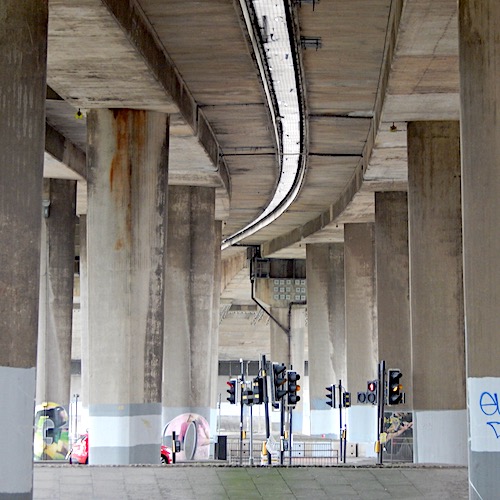
South of the expressway, it is clear that the car is king: pedestrians are edged away from the high-speed action and into over-leafy side paths, with very restricted sight lines (trees, concrete supports for overhead slip roads and pedestrian overpasses, stalled spaces, blank walls).
It’s not comfortable, and sectarian graffiti doesn’t help. “F– the King” at Warroch Street, the last word over painted to read “Pope”. I’ve been seeing the same words since I was a lad. Few things change. “Shitugees go home” was a new and very unwelcome one, though.
Then, between Argyle Street and Anderston Quay, the deck of the motorway rises towards the Kingston Bridge, which crosses the Clyde 60 feet above sea level. Between the pillars, a vast sea of wasted space, only a sliver given over to charging points for electric taxis. Alongside this concrete cathedral, a path runs to the south, interrupted by a large circle made of cobbles, a recycled road surface from a previous highway.
Nearby, Cheapside Street, a truncated remnant of red sandstone tenements, speaks of an imported London street name, and a name imprinted on generations of Glaswegians. The Cheapside Street Disaster has been described by the Fire Brigades Union as “one of the worst peacetime fires in British history”, in which 19 members of the fire service and salvage corps were killed.
Fire broke out in a bonded warehouse between Cheapside Street and Warroch Street, a few hundred yards north of Broomielaw, on 28 March 1960. The warehouse contained a million gallons of whisky in 21,000 wooden casks and 30,000 gallons of rum, which presented such a threat that every city fire engine and more than 450 fire fighters were called to action.
When the heat caused the boiling liquid to massively expand and burst into flame, the front and rear walls of the warehouse collapsed onto the 14 fire fighters and five members of the Glasgow Salvage Corps. The fire, which spread to adjacent businesses including an ice cream factory and a tobacco warehouse, burned for a week. The salvage corps, incidentally, was funded by insurance companies to rescue property and minimise damage to insured buildings and goods.
There is a small memorial on the Clydeside walkway on the east side of the Kingston Bridge, perhaps a more prominent site but quite distant from the disaster. The large monument, in Glasgow Necropolis, is probably the most visited in that cemetery. There continues to be a ceremony there each year on the anniversary of the disaster.
Now, the looming behemoth of the Kingston Bridge. The Scottish Roads Archive offers an amusing anecdote: “The slip-roads and approach viaducts [of the bridge] would be carried on [pairs of] more than 100 slender supports with an ‘interesting and elegant’ parabolic cross-section that quickly earned them the affectionate nickname Wullie Fairhurst’s Troosers, a reference to the bridge’s designer.”
No pedestrians need apply
Troosers or not, there’s a smell of raw sewage at the main support of the Kingston Bridge, north side, in front of a mural showing swimmers from the Commonwealth Games in 2014, created by Smug (Sam Bates). We can’t cross the river here, so we take a diversion to the south side across the Kingston Footbridge (known locally as the Squiggly Bridge), walking past a Cubist tree, topiary by Georges Braque. The Lorne sausage of urban trees.
Rejoining the GIRR route, we see more textbook Grey Belt areas below the bridge north and south of Paisley Road. Not even a car park. Concrete blocks preventing parking, some graffiti, some blown rubbish. No apparent use or value.
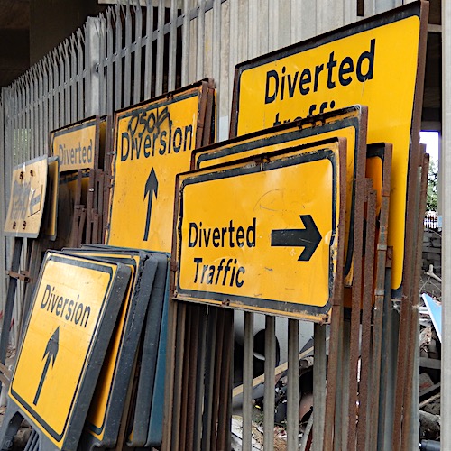
We now process along Carnoustie Street, then on a narrow pavement next to a store for road signs, a device for painting lines, rubble from street repairs. Multi-lane crossings in dense fast traffic. No pedestrians need apply. Empty spaces, killed, sterilised (if they weren’t so dirty) by car mania. Junk from trunks everywhere. Fast food detritus, chips from reflective strips, rubber bumpers, unidentified bits and pieces.
In the original plans for the ring road, the crossing of the Clyde was by the Carnoustie Street Bridge, later renamed the Kingston Bridge in honour of the local area. Carnoustie Street (once Crookston Street), was previously a thriving thoroughfare of shops, pubs, houses and a school, and is now a traffic channel, a deleted street with no purpose other than funnelling traffic onto and off the M8, a metaphor for the whole ring road project.
Two snapshots from the last section of the walk. Below the Kingston Bridge, south side, two Chinese women, taking photographs of each other. At the lights near the ski slopes, a blonde in a black SUV looks daggers at me, taking pictures of apparently nothing. Nothing visible to a determined motorist, anyway.
Closing the circle, as we approach the ski jumps from the west, an example of rehabilitation appears. After all the planning blight, Grey Belt wastelands and stalled spaces, it’s heartening to see a concrete canyon adopted by a community and put into productive use.
Skateboarders, those urban survivalists, have claimed the empty space below the on- and off-ramps south of Wallace Street, and now loop and grind around the Kingston DIY Skatepark. Maybe there’s hope for all the other abandoned and lost spaces of the Glasgow Inner Ring Road.
CODA: What next for the GIRR? Replace the M8 is a grassroots campaign group set up by Peter Kelly on Twitter (now X) which accepts that the M8 was an important economic route, but argues that the costs of having a motorway scything through Glasgow are larger than the benefits. The group asserts that the urban motorway has a detrimental effect on the city’s image, and has lowered land values, affected air and noise quality, and damaged pedestrian safety, accessibility and active travel. Scottish and local government policy, as well as economics, will determine whether the group has any effect on the tarmac curtain. Watch this space.
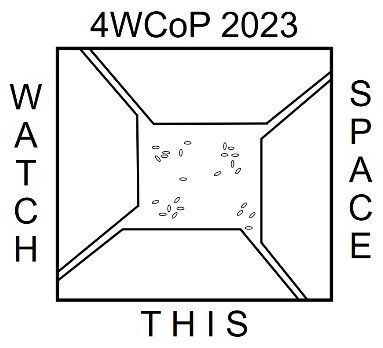
This piece was selected to be part of the Fourth World Congress of Psychogeography. The postcard, and a short presentation describing the walk, was featured in the finale on Saturday 9 September 2023.